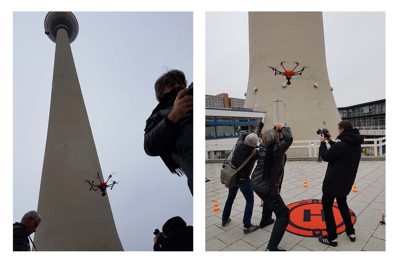
3D mapping of Berlin’s radio tower
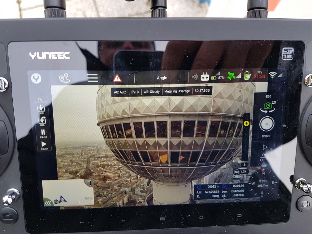
It was a very special mission: A professional and high-precision survey of Berlin’s radio tower – carried out with the Yuneec H520. On behalf of the DFMG Deutsche Funkturm GmbH, the 368 m high landmark was inspected with a drone for the first time. Together with the company Droniq, the Yuneec team was asked to create a 3D mapping of Berlin’s radio tower at the Alexanderplatz. The technically demanding project in the restricted flight area ED-R 146 required a sophisticated safety concept. It was clear to all involved parties that only an exceptionally safe and reliable aircraft could be used in the middle of Berlin city with its extensive public traffic and its location close to the protected government district of the Federal Republic of Germany.
The suitable tool – the YUNEEC H520
The H520 Hexacopter with its 6 rotor system is extremely stable and equipped with extra safety reserves. Also, the drone is well shielded against external disturbances. To prove this, the German Federal Ministry of Transport and Digital Infrastructure asked for a test. Under the exclusion of the public and with the participation of the Federal Ministry, the Yuneec team completed a test flight in strong wind and drizzle at a lonely radio tower. After the successful test flight, nothing stood in the way of an exemption for the ascent in the no-fly zone. So in November 2019, all necessary papers were available and the mapping was made by the Yuneec team, monitored by authorities. After around 4000 photos, the mission was completed and the necessary data collected.